 |
| The Inca Trail to Machu Picchu
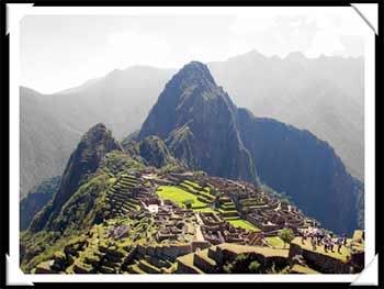
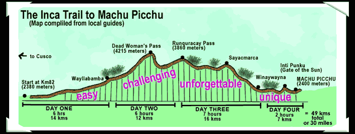
The lost Inca city of Machu Picchu is said to be one of the eight wonders of the world and the most spectacular archeological site in the South American continent. We chose to do the Inca Trail (or Inca TRIAL as it's dubbed) that weaves for four days and 30 miles high in the Andes mountains as our route to great lost city. |
|
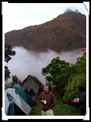
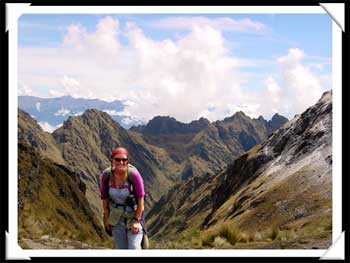
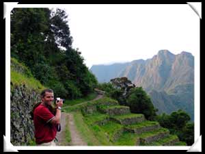
This was our first morning on the trail (right). The porters woke us up early in the mornings while we were still in the tents with a hot cup of tea...usually coca.( Most of us weren't used to such service while trekking, but we didn't complain.) So popular has the trail become that they have recently made it required that you go escorted by a guide. They have also cut the number of hikers allowed on the trail each day as well. It still could get crowded, though. The high craggy Andes mountains were spectacular scenery. The tops were snow covered and the nights could get cold. We weren't allowed to make fires in the evening because the surrounding environment couldn't handle the demand for firewood. Instead we all huddled together at tea time (5:30 PM) and drank hot tea and ate loads of popcorn while the cooks prepared dinner. The food was excellent and we ate a lot. We were burning tons of calories on the trail and we were fed according to that need....carbohydrates. porridge and pancakes for breakfast, soup and rice or pasta for lunch, soup and potatoes stew for dinner.. |
 |
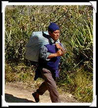 |
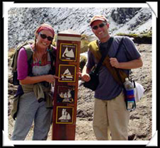
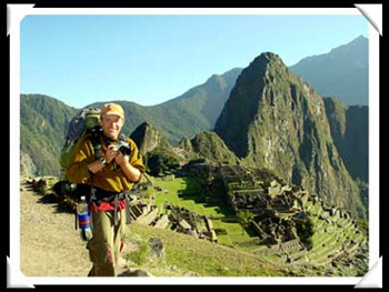
We had twelve porters and a cook (right) that escorted our group of 14 trekkers. It was hard work and they all did an amazing job. We were huffing and puffing on the trails and they would pass us carrying four times the weight on their backs( usually with only a flour sack to carry it all in). |
 |
|
Dead Woman's
Pass |
 |
 |
That's snow in the back of us on the picture to the left. Immediately after summitting the pass, our guide quickly shuffled us back down the other side where lunch was waiting. |
 |
|
There were a lot of great people on the trail with us. Here are Graham and Diane from Australia posing with the "Princess and his Peas". (The Princess somehow would end up with a lot of rocks strategically placed under his tent at night.) We didn't have access to showers until the last campsite and l had to huddle together under a small tent at meals yet we all still seemed to enjoy each others company on the trail. |
 |
|
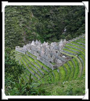
The last two hours on the third day were a tortuous solid downhill (I much prefer going up, although Brian would disagree.) The constant battering of downhill knocked your toes to the front of your shoes and made your knees wobble. We arrived to camp with just enough time to see the ruins of Winaywayna (right). |
 |
 |
 |
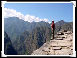
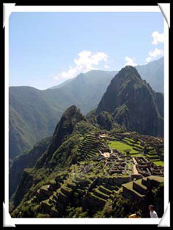
The next morning the porters woke us up at 4:00 AM to begin the last leg of our hike to reach Machu Picchu by sunrise. There were many other groups that were doing a shorter hike and converged with us and the trail got a little over-congested at this point. Yet we hustled on in the dark to fight our way to the sun temple. It seemed strange that we were actually hiking DOWN to Machu Picchu. (All the pictures I had seen seem to show it hovering at the top of the world.) However, once we arrived and saw the lost city we were far above it. As instructed by our guide we sat.....and sat.....and sat....as the sun slowly moved....and an hour later....finally shown on the ruins themselves. As happy as we were to finally arrive at Machu Picchu, I think we all would have preferred an extra hour of sleep to all the pushing and shoving it took to get there at "sunrise". |
|
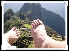
Nonetheless, it was truly breathtaking. We found a nice grassy spot with a view and let our feet air out for a hour or so. (The little tootsies were hamburger after walking 30 MILES to get here!) So It was nice to sit still and just image how this all used to look some 550 years ago. |
 |
 |
|
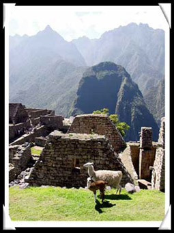
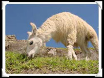
Llamas roamed freely around the ruins. They served a dual purpose, both to please the visitors like us, and to keep the grass cut to a manageable level. Our guidebook mentioned that in 2001 Japanese scientists caused quite a shiver when they concluded that the steep slopes on the west side of the city (where we were sitting) were in threat of a possible "catastrophic landslide"....soon. There were a couple of guys walking around with surveying equipment that must be regularly checking this data. |
 |
 |
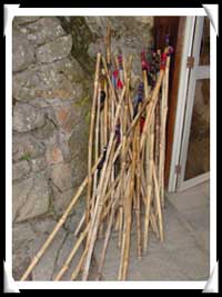 |
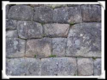
Just outside the ticket booth was a stash of confiscated bamboo walking sticks. It probably wasn't even 8:30 AM yet and these were taken from the hikers coming in from the Inca Trail. We think they are then re-circulated to be sold to the next batch of hikers. The stonework was amazing. Look to the picture to the right and see how tightly they managed fit all the granite together. |
 |
|
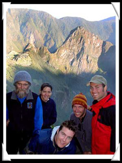
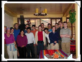
A group shot before everyone boarded the train back to Cusco...(except Brian and I). We stayed behind to spend the night at Aguas Caliente at the base of Machu Picchu and relaxed our weary muscles in the nearby hot springs. |
 |
 |
 |